
GMet Presents Ghana Climate Atlas to Ghana Hydrological Authority
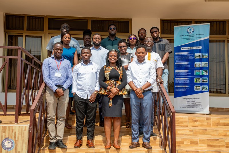
The Ghana Meteorological Agency (GMet) on Monday, 26th January, 2026 continued its series of stakeholder engagements with a presentation of the Ghana Climate Atlas to the Ghana Hydrological Authority, as part of efforts to validate the tool with key institutions ahead of its official rollout.
The engagement took place at the office of the Ghana Hydrological Authority, where the GMet delegation was received by the Deputy Director of the Zonal Office and Coastal Infrastructure Specialist, Dr. Ing. Richard Asumadu. He welcomed the team and underscored the importance of access to reliable, localized climate information, particularly for institutions responsible for managing water resources and coastal infrastructure.
Dr. Ing. Asumadu noted that climate variability and change continue to pose significant challenges to Ghana’s coastal and inland water systems and emphasized the need for climate products that can support long-term planning and infrastructure design. He expressed interest in how the Ghana Climate Atlas could complement hydrological assessments, flood risk analysis, and coastal protection efforts.

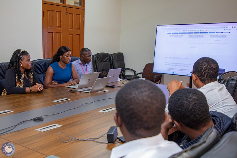
The Climate Atlas Project Lead, Ms. Maureen Abla Ahiataku, led the main presentation on the Ghana Climate Atlas, highlighting its purpose, development process, and key climate indicators. She explained that the Atlas brings together downscaled global climate models and soon Ghana’s observed climate data to provide localized, decision-relevant climate information.
“The uniqueness of the Ghana Climate Atlas lies in the integration of global climate projections with our own observed data, allowing us to understand climate change impacts at scales that are meaningful for national and sectoral planning,” Ms. Ahiataku stated.

The visualization and technical features of the Atlas were presented by Ms. Joana Amavih, who demonstrated the interactive dashboard, map viewer, story maps and data exploration tools designed to make climate information more accessible to both technical and non-technical users.
The engagement followed the same validation process undertaken with other stakeholders, providing Hydro officials the opportunity to ask questions, share feedback, and discuss how the Atlas could be applied within their operational and planning activities. Discussions focused on potential use cases related to flood management, coastal infrastructure development, and water resource planning.
The session formed part of a broader stakeholder engagement process under the Ghana–Denmark Strategic Sector Cooperation, implemented by GMet in collaboration with the Danish Meteorological Institute and with support from the Embassy of Denmark in Ghana. Inputs from institutions such as the Ghana Hydrological Authority will help refine the Ghana Climate Atlas to ensure it is fit for purpose and responsive to the needs of key users before its official launch.


©️GMet Communications